

Burnet to participate in flood study, contribute to state flood plan
Several homes at the southern end of Oak Street in Burnet were destroyed in the July 5 flooding, many of which are situated near Hamilton Creek’s floodplain. File photo
The city of Burnet will look to further bolster its flood preparedness in the coming months by participating in a flood management evaluation study to be performed by the Texas Water Development Board.
The study, aimed at providing the state with a closer look at how water moves through cities during major flooding events, will include detailed analysis of flood-prone areas and an evaluation of how to improve infrastructure for flood control.
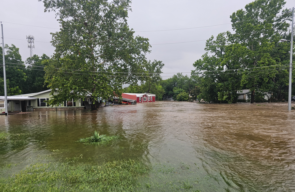
Hamilton Creek will be at the forefront of the study, and the city’s participation may allow for flood improvement funding from the state in the future. That waterway is normally a tranquil stream that flows through Burnet, but it swelled to destructive proportions during the July 2025 flood event, sweeping away homes, people, and property.
“While the study will not result in immediate construction, this is a critical step forward,” City Manager David Vaughn said. “Completing this work will position the City to be eligible for future state funding to implement flood control projects along Hamilton Creek. For a smaller community like Burnet, this type of support is essential to moving meaningful projects forward.”
The study is part of a larger Texas initiative to create a state flood plan every five years. In 2019, the Texas Legislature approved Senate Bill 8 to mandate the first state flood plan, to be directed by the TWDB.
The bill detailed requirements for a comprehensive plan for orderly preparation protecting against the loss of life and property, developing a guide for state and local flood control policy, and contributing to water development.
To cover the many different geographies throughout the state, fifteen planning regions have been created to contribute to the state flood plan. Burnet County is included in the Lower Colorado-Lavaca Regional Flood Planning Group – Region 10, which consists of 43 counties.
According to the Region 10 website, the area has witnessed 110 major flood events in the last 20 years, and 50 major disaster declarations and six emergency declarations from 1953-2020.
Those numbers have only risen, and the damage caused from the July 5 flooding last year has further shown the need for preparedness throughout the state.
“The July 2025 flood highlighted the need for long-term solutions, and this study will help guide those efforts,” Vaughn said.
Previous flood recovery reporting
- “Burnet considers buyouts for high-flood-risk properties,” Aug. 29, 2025
- “FEMA aid available for remaining flood debris cleanup,” Oct. 21, 2025
- “Burnet removes local state of disaster following July floods; reconstruction efforts continue,” Jan. 28, 2026
- “Burnet County to get flood warning sirens,” Feb. 19, 2026
- “Hamilton Creek playscape reopens as flood recovery progresses,” March 2, 2026
- “Burnet leaders talk flood recovery, bond package at state of the community,” March 5 2026
- “Burnet approves major flood buyout program with NRCS,” April 8, 2026