

Winter storm looms over Highland Lakes; forecast, resources, and updates
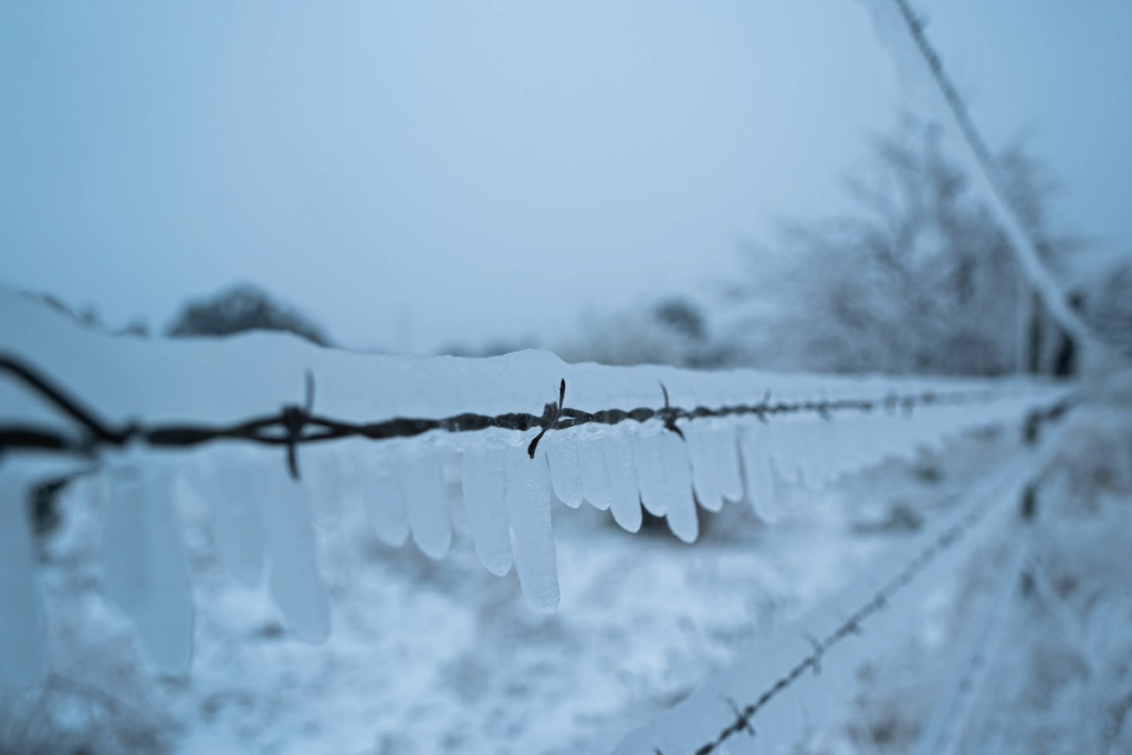
A fenceline encased in ice during the winter storm of 2021. Staff photo by Dakota Morrissiey
Editor’s note: This story has been made ‘free’ and is viewable without a DailyTrib subscription for the benefit of Highland Lakes area residents’ safety during the expected winter storm Jan. 23-26.
A winter storm is on the doorstep of the Highland Lakes area, and it will likely bring sub-freezing temperatures, dangerous travel conditions, and possible power outages.
According to a forecast from the National Weather Service, as of 2 p.m. on Friday, Jan. 23, the storm is expected to hit on Friday night and bring temperatures in the high 20s with 100 percent chances of showers that could develop into freezing rain. One to two inches of precipitation are expected.
Rain and freezing rain is likely to continue through Saturday morning and early afternoon, then sleet is likely after 3 p.m.
The temperature will likely plummet on Saturday night, dropping into the teens. Wind gusts of up to 20 mph are expected along with 100 percent chances of precipitation.
More precipitation could come on Sunday morning, but skies are expected to clear on that day. Temperatures will likely not rise above freezing and may even drop into the single digits.
Current forecasts show Monday with clear skies, but highs below freezing and single digit lows.
Temperatures could rise above freezing by Tuesday.

Possible power outages
The Pedernales Electric Cooperative and Central Texas Electric Cooperative are each warning of potential power outages during and after the winter storm.
PEC, which serves most of Burnet County, has work crews on standby in case of outages.
- Prepare homes by dripping faucets and insulate outdoor pipes
- Insulate indoor pipes near a home’s exterior
- Charge cell phones, computers, and portable battery banks prior to the storm
- Have a plan for perishable foods that require refrigeration or freezing temperatures
- Plan for the loss of internet access
- Plan for ways to keep warm without central heat or electric space heaters
- Plan for ways to keep pets, livestock, and plants warm
- Keep bottled water accessible and away from the cold
- Do not use gas heaters in enclosed spaces
Supplies and panic buying
Some businesses may see “panic buying” of supplies and certain foods leading up to and through the winter storm.
As of Friday, Jan. 23, DailyTrib staff observed big clearouts at H-E-B, but little impact at Walmart.
The H-E-B in Marble Falls, at 1503 RR 1431, was out of eggs, most of its perishable dairy products, and much of its unfrozen meat as of 11 a.m. on Friday. The store still had ample supplies of toilet paper, produce, bottled water, and most other necessities.
Walmart in Marble Falls, at 2700 U.S. 281, did not seem to have been hit by the same panic shopping as H-E-B and had a regular stock of all items.
Warming centers
Ark of Highland Lakes will have two 24-hour warming centers open starting at 8 a.m. Saturday, Jan. 24, and they will likely remain open until freezing conditions subside. The centers will serve as refuge for residents in need that may not have access to warm or comfortable conditions during the storm.
Volunteers are still needed to help man the centers. Contact Ark at 325-423-3662 to learn more or to offer your aid as a volunteer.
- Marble Falls warming center- St. John’s Catholic Church, 105 RR 1431
- Burnet warming center- First Methodist Church, 301 E. Graves Street
School closures
The winter storm may lead to school closures on Monday, Jan. 26, if dangerous conditions continue.
- The Marble Falls Independent School District will decide by 8 p.m. on Sunday whether or not changes will be made to Monday’s schedule. All school activities scheduled for Saturday and Sunday are canceled. Follow the district’s social media for updates over the weekend.
- The Burnet Consolidated Independent School District is monitoring the storm and will provide updates on potential changes to hours or closures as needed. Follow the district’s social media for updates over the weekend.
- The Llano Independent School District is monitoring the storm and will provide updates on potential changes to hours or closures as needed. Follow the district’s social media for updates over the weekend.
Dangerous travel conditions
The Texas Department of Public Safety and the Texas Department of Transportation are both cautioning residents to avoid travel during the storm or to exercise extreme caution if driving.
- Stay aware of rapidly changing weather conditions
- Allow extra time to reach your destination
- Reduce speed and increase follow distances
- Carry an emergency kit in your vehicle
- Share your travel plans with a friend or family member
- Be extremely cautious when traveling in areas with poor cell phone reception
- Watch for downed trees and power lines
- Bridges and overpasses will accumulate ice faster than other portions of the road