




After the flood: full lakes, rivers recede, and local communities remain relatively unscathed
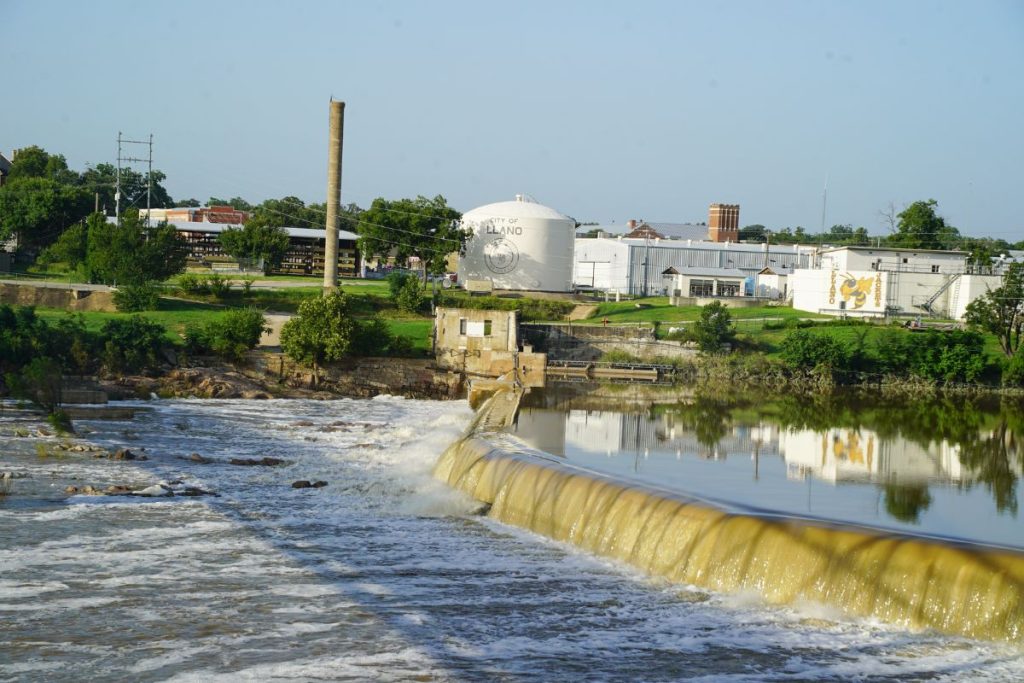
The level of the Llano River has mostly returned to normal in Llano following major flooding last week. Staff photo by Dakota Morrissiey
The Llano River surged from its banks starting on Thursday, July 16, sending billions of gallons of water downstream. Despite the flood conditions, Llano and Burnet counties endured minimal negative impacts and Highland Lakes reservoirs are full for the first time since 2019.
See the Friday, July 17, DailyTrib story “Highland Lakes floodin; more on the way” for coverage and photos during the flood event.
Llano County
According to the Llano County Office of Emergency Management, there was reportedly no serious property damage during the flood.
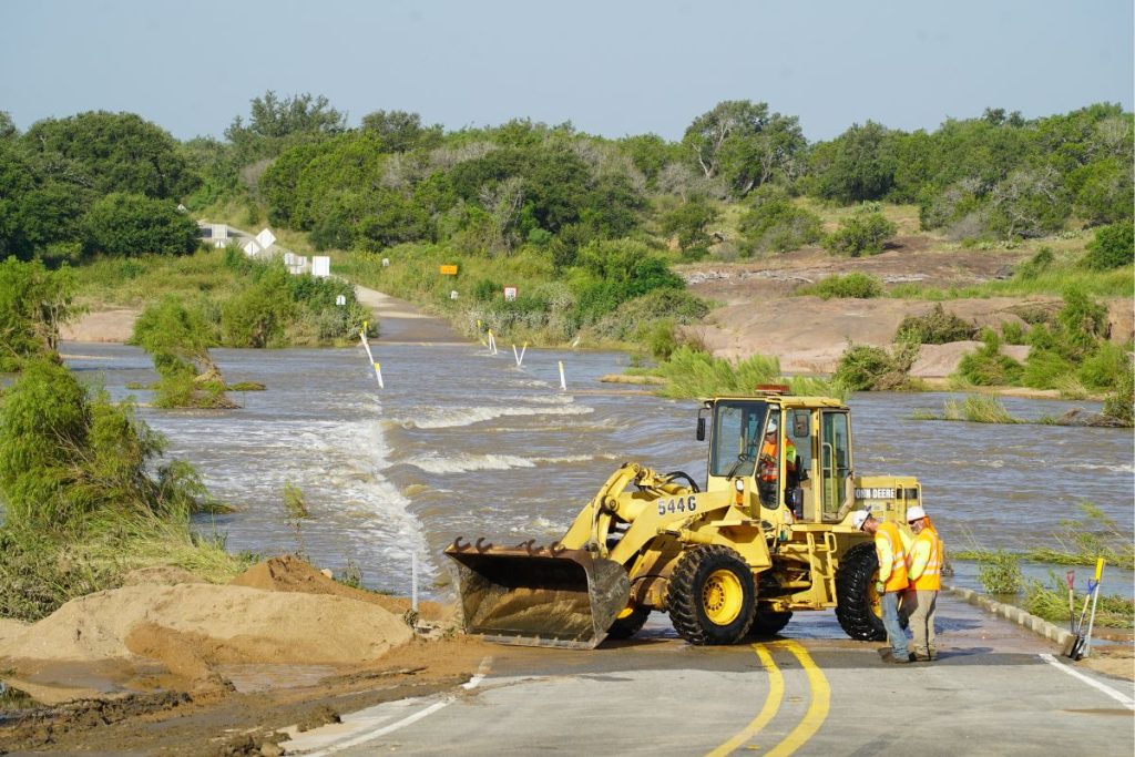
The greatest impact to the county is the continued closure of CR 307, better known as Slab Road, and CR 102 as of Monday, July 20.
The river had mostly receded by Monday. A Texas Department of Public Safety crew was seen clearing debris and sediment from the Slab Road on Monday morning, but the route was still closed.
According to Llano County Emergency Management Coordinator Gilbert Bennett, the county does not typically see major property damage unless the Llano River reaches extraordinary heights, like in the October 2018 flood, when it rose over 39 feet at the Llano Dam.
The Llano River had two major crests during the recent flood event. The first crest was at around 6 p.m. on Thursday, July 16, when it rose to 20.24 feet at the Llano Dam, flowing at about 74,702 cubic feet per second. It spiked again at around 11:25 p.m. on Saturday, July 18, rising about 20.83 feet and flowing at 79,182 cfs.
The river normally flows around 140 cfs.
On Friday, July 17, flood prediction models from the National Water Prediction Service showed that the Llano River was expected to rise around 25 feet, but that never came to be.
Lake Marble Falls
Lake Marble Falls was still closed to recreation as of Monday, after being closed to the public on July 16 as a precaution due to floodgate operations and debris that could cause dangerous conditions on the lake.
The LCRA opened multiple floodgates to manage the flood water coming from the Llano River. Floodgates on Wirtz Dam, which creates Lake LBJ, and on Starcke Dam, which creates Lake Marble Falls, were opened on Thursday, July 16.
The Llano River feeds into Lake LBJ near Kingsland, where it merges with the Colorado River. Water from Lake LBJ then passes down to Lake Marble Falls and then in to Lake Travis.
Lake Travis
According to the LCRA, Lake Travis is more than full as of Monday, July 20. It sits at 683.97 feet above mean sea level as of midday on Monday, almost 3 feet over its 681-msl full marker.
The lake had risen over 12 feet since flooding began on Thursday, July 16. Not all of that water came from the Llano River, some came from the massive flooding of the Pedernales River as well.
In total, Lake Travis gained about 225,500 acre-feet of water between Thursday and Monday. That comes out to around 73.31 billion gallons of water, enough to fill Lake Marble Falls over 30 times.
The last time Lake Travis and Lake Buchanan were both completely full was in July 2019. While Buchanan may look larger on a map, Lake Travis is holding 26.66 percent more water than Lake Buchanan as of Monday.
With Lake Travis 105 percent full, floodgate operations are underway on Mansfield Dam and Miller Dam in Travis County.
Rain
The flooding of the Llano River was fueled by enormous amounts of rain that fell over a relatively short time in counties farther to the west.
Starting on July 14, torrential rain began to fall throughout the Llano River’s basin. According to the LCRA Hydroment, by July 17, Llano County saw significant rainfall, as high as 4.74 inches in some locations, but that paled in comparison to totals like 12.18 inches in Mason County and 13.96 inches in Kimble County.
While it was not in the Llano River’s basin, an LCRA rain gauge near Spanish Oak Creek in Gillespie County measured 17.41 inches in the same July 14-17 time period. All of that water fed into the Pedernales River, and ultimately Lake Travis.