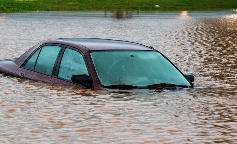
MARBLE FALLS — Floods are a fact of life in the Highland Lakes, but local and federal officials want to ensure the safety of people and property through planning. A big tool in that process are federal flood maps, which are up for revision.
A public open house to share federal flood map changes and flood risk information with residents in Burnet and Williamson counties is 2-7 p.m. Tuesday, April 24, at Lakeside Pavilion, 307 Buena Vista Drive.
Officials with the counties and the Federal Emergency Management Agency are presenting the maps to help leaders and residents identify known flood risks and use that information to make decisions about future development as well as to purchase flood insurance.
Homeowners, renters, and business owners in both Burnet and Williamson counties are encouraged to attend to obtain more information about the proposed changes and risk information.
“As we work together with our state and local partners to bring this critical information to these counties, we ask that everyone review the maps to understand what flood risks are involved,” said FEMA R6 Administrator Tony Robinson. “The role of the community as an active partner in the flood mapping process is very important.”
For more information, including links to the interactive mapping website, go to www.riskmap6.com.
News stories, staff photos, and other online content are copyrighted property of Victory Media. Reproduction in part or in whole is prohibited without the express written consent of the publisher.
This Content Submission and License Agreement (“Agreement”) is entered into by and between Victory Media Marketing LLC (“Company,” “we,” or “us”) and you (“User,” “you,” or “Submitter”) upon your submission of content through our websites’ See it, Share It form.
Submitted Content “Submitted Content” means any news tips, text, descriptions, images, photographs, videos, audio files, recordings, or other materials you upload, submit, or provide to us via the news tips forms on DailyTrib.com, KBEYfm.com, 101highlandlakes.com, or any other websites owned or operated by Victory Media Marketing LLC.
License Grant By submitting any Submitted Content, you hereby grant to Company a worldwide, non- exclusive, perpetual, irrevocable, royalty-free, fully sublicensable, and transferable license to use, reproduce, modify, adapt, publish, translate, create derivative works from, distribute, perform, display, and otherwise exploit the Submitted Content in any form or medium (now known or hereafter developed), including but not limited to:
Publishing on DailyTrib.com, KBEYfm.com, 101highlandlakes.com, other Company websites, apps, newsletters, and social media platforms (such as Facebook, Instagram, X, YouTube, etc.).
Editing, formatting, or combining with other content for news, promotional, archival, or commercial purposes.
Allowing third parties (e.g., affiliates, syndication partners) to use it under the same terms. You retain ownership of the copyright in your Submitted Content, subject to the license granted above.
User Representations and Warranties You represent and warrant that:
You are at least 18 years old and have the full right and authority to grant the rights in this Agreement.
The Submitted Content is your original work or you have obtained all necessary permissions, consents, and releases (including from any individuals appearing in photos/videos or owners of any third-party materials).
The Submitted Content does not infringe any third-party intellectual property rights, privacy rights, publicity rights, or defame any person.
It complies with all applicable laws and does not contain viruses, malware, or prohibited content.
You will not submit false, misleading, or confidential information.
No Compensation You understand and agree that you will receive no compensation for the submission or use of your Submitted Content.
Indemnification You agree to indemnify, defend, and hold harmless Company, its affiliates, officers, directors, employees, and agents from any claims, damages, liabilities, losses, and expenses (including reasonable attorneys’ fees) arising from your breach of this Agreement or any third-party claims related to your Submitted Content.
Moral Rights and Publicity You waive any moral rights or rights of attribution in the Submitted Content to the extent permitted by law. Company may use your name, username, or likeness in connection with the Submitted Content if applicable.
Termination and Removal Company may, in its sole discretion, edit, refuse to post, or remove any Submitted Content at any time without notice. This Agreement survives any termination.
Governing Law This Agreement is governed by the laws of the State of Texas, without regard to conflict of laws principles. Any disputes shall be resolved exclusively in the courts located in Burnet County, Texas.
Entire Agreement This Agreement constitutes the entire understanding between the parties and supersedes all prior agreements. Modifications must be in writing. By submitting content, you acknowledge that you have read, understood, and agree to be bound by this Agreement.


 MARBLE FALLS — Floods are a fact of life in the Highland Lakes, but local and federal officials want to ensure the safety of people and property through planning. A big tool in that process are federal flood maps, which are up for revision.